Weird And Interesting Maps That Depict The World Differently
Advertisement
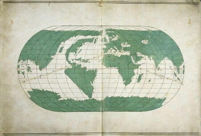
An Accurate 1567 Map By Ottoman Sailor Ali Macar Reis
While we take satellite images and Google Earth for granted today, it's easy to forget just how much of an accomplishment it was to create an accurate map of Earth centuries ago. This map was drawn by an Ottoman sailor named Ali Macar Reis in 1567, and it's extraordinarily accurate for its time. All of the continents are there, even if North America looks a little leaner compared to how we know it looks.
commons.wikimedia.org
Perhaps one of the most incredible things about this map, and other ancient maps like it, is that Antarctica is included despite not being visited until the early 19th century. The ancient Greeks had theorized that it existed despite no one ever traveling there.