Weird And Interesting Maps That Depict The World Differently
Advertisement
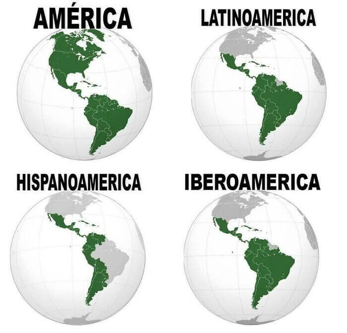
A Map Of The Americas
This interesting little map breaks up the continents of North and South America (or just America, depending on where you went to school) into different zones. The top left map shows the entirety of America, while the map in the top right corner shows Latin America. The bottom left shows countries with historical ties to Spain, while the bottom right shows countries with historical ties to both Spain and Portugal.

Reddit
There are a couple of territories and countries here that still belong to European countries, such as French Guiana, so they are grey on all four of the maps.


