Maps That Show How The World Really Is
Advertisement
North America At Scale
Lots of people go to school to learn about geography or the art of mapmaking through applications like Geographic Information Mapping System. For anyone who has put the time in to learn about size comparisons, they know that maps are not always scaled correctly.
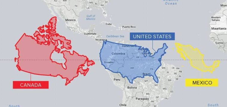
Visual Capitalist
The United States tends to be given a spot of prominence and enlarged in maps when really, South America and Africa are much larger. When looking at maps, always keep scale in the back of your mind.