Maps That Show How The World Really Is
Advertisement
Understanding Mercator's Projection
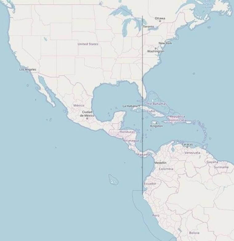
Mercator's Projection is by no means a new way of designing maps. In 1569, a man by the name of Gerardus Mercator introduced his mode of mapping. It is the process of using meridians, lines of latitude and longitude, and following the equator to create a cylindrical projection.
Libre Space
This method of mapping continues to be used, especially in navigation charts. The problem with this method of mapping is that it is not always accurate. As the lines used do not always display exactly where continents should be situated on a flat map.