Maps That Show How The World Really Is
Advertisement
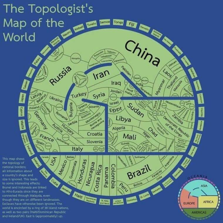
Countries That Share Borders
By examining a map, it is obvious what countries share borders. The Topologist's Map of the World shares a slightly different view though. Instead of staring at a traditional map of the world, the Topologist's Map places countries that have borders that touch by continent.
twitter.com
Each continent is separated by a blue line, and the small curved rectangles that circle the continents are islands that don't border them directly but are in the same vicinity. Conceptually, this map is very easy to understand, although it does not accurately show landmass to scale which is a limitation. This is just another way of looking at the world